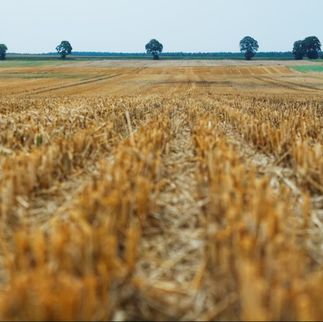
A farm in the Lake Simcoe watershed, one of our field sites. Source: Lake Simcoe Region Conservation Authority (https://lsrca.on.ca/index.php/funding-expertise/on-the-farm/)
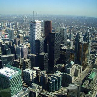
Near the outlet of Black Creek, one of our research sites. Source: TRCA (https://trca.ca/conservation/flood-risk-management/flood-risk-area-rockcliffe-smythe/)
|
The stream pictured on the banner above is Nissouri Creek, one of our field sites. While it looks pristine, it drains a watershed that is nearly covered by intensive agricultural production. Watersheds like Nissouri Creek have not been well studied by hydrology. Our research group's mission is to answer two questions:
How does precipitation become streamflow, and how does streamflow mobilize materials of interest (sediment, nutrients, contaminants) in human dominated watersheds? What role do human activities play in hydrology and water quality, and how could human activity have less of an impact on hydrology and water quality? We have below more information on ongoing research projects. Water Quality in Lake Simcoe At the edge of the Greater Toronto Area and cottage country, Lake Simcoe is a priority area that is home to 450,000 residents and is growing rapidly. It is also home to some of the best farmland in Canada. Lake Simcoe is dealing with pressures from agricultural production, urbanization, and climate change. We are examining how beneficial management practices can be prioritized to the specific locations on the landscape in Lake Simcoe's basin, and examining how those management practices can hold up to climate change. This involves the integration of mathematical models of nutrient loss, an extensive field sampling campaign, and a participatory modelling piece that elicits detailed inputs from stakeholders in the model application and scenario analysis. We are also working on a mass balance to assess future chloride levels in Lake Simcoe. This is an exciting initiative that will lead to science based recommendations for road salt management in the Lake's Watershed. Urban Hydrology in the Greater Toronto Area Urban watersheds are among the least well understood types of watersheds, yet are home to a majority of the world’s population. I am beginning three projects to better understand urban hydrology and water quality. The Greater Toronto Area is the fourth largest metropolitan area Canada and the US, and is expected to add 4.5 million additional residents by 2050. This growth presents a significant water quantity and water quality challenge if it is to take place without straining stormwater infrastructure or downstream ecosystems. We have a few projects in this area: Detailed soil property mapping using a combination of UAV imagery, machine learning, and field work. This work will allow us to better assess the role of urban soils in urban water quality. Assessing the concentration-discharge dynamics of contaminants in watersheds along a gradient of urbanization. This involves statistical analysis of extensive records of concentration and discharge, and cross referencing these with land use mapping to assess how different land uses influence contaminant dynamics. Integrating water tracers with mathematical models of watersheds to infer surface and subsurface flowpaths in complex urban watersheds. This will also illuminate the paths contaminants take from the built environment to streams. |